Knowing the air quality index will give an idea to you about the ongoing pollution and how safe the atmosphere of a region is. Let us assume you have breathing issues or a dust allergy. Then knowing about the air quality index of a region you are traveling into, will help you to take sufficient measures to keep yourself safe from polluted air. Also, we know how wildfires create havoc and keep going for months and weeks. If you are a traveler, then having information about wildfires will help you to find alternate routes for traveling.
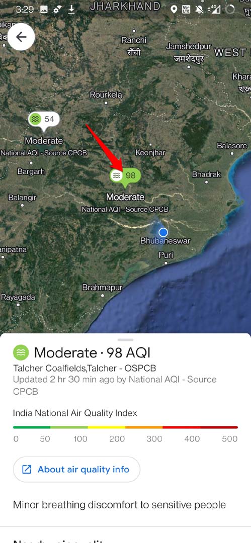
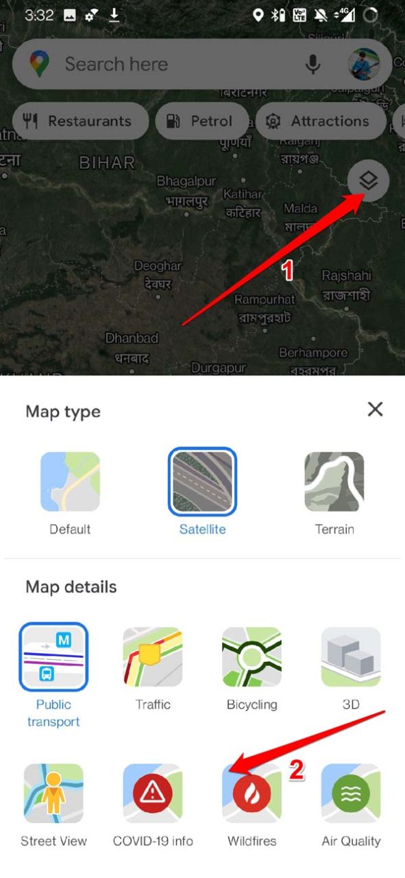
Check Air Quality Index on Google Maps
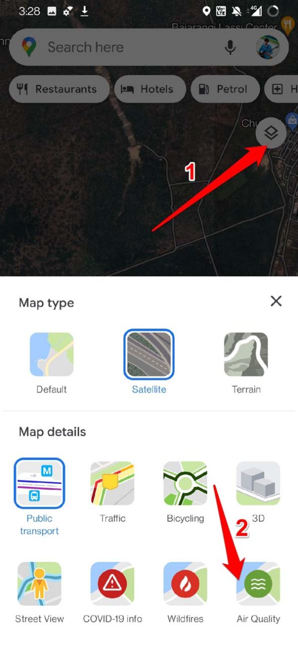
This feature is only available for the mobile version of Google Maps. If you are accessing Google Maps from your PC browser, you will see no option to check for air quality index in your region. Maybe in the coming days, Google will make the Air Quality Index check feature available to more nations around the world. Here are the steps to check the Air Quality Index on Google Maps. You may wonder where Google Maps gets the accurate and latest information regarding the Air Quality Index of these countries. Well, Google Maps fetches the data from popular bodies that deal with Environment protection. In India, the information regarding air quality is derived from the National AQI of India. Similarly, in Australia, there is EPA Victoria. There are also other environmental agencies such as AirNow or PurpleAir. These bodies have dedicated research teams that update information regularly. So, the data regarding the Air Quality Index you see is trustable and genuine.
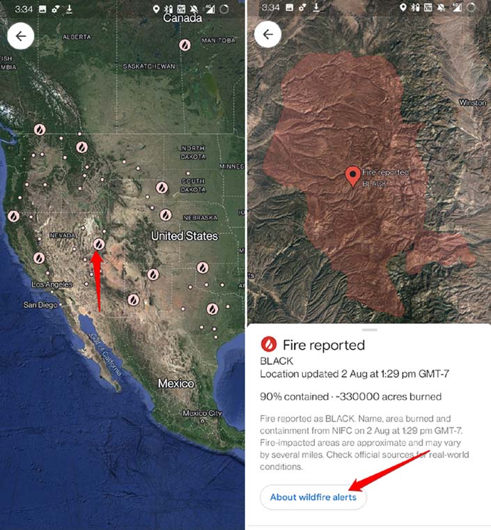
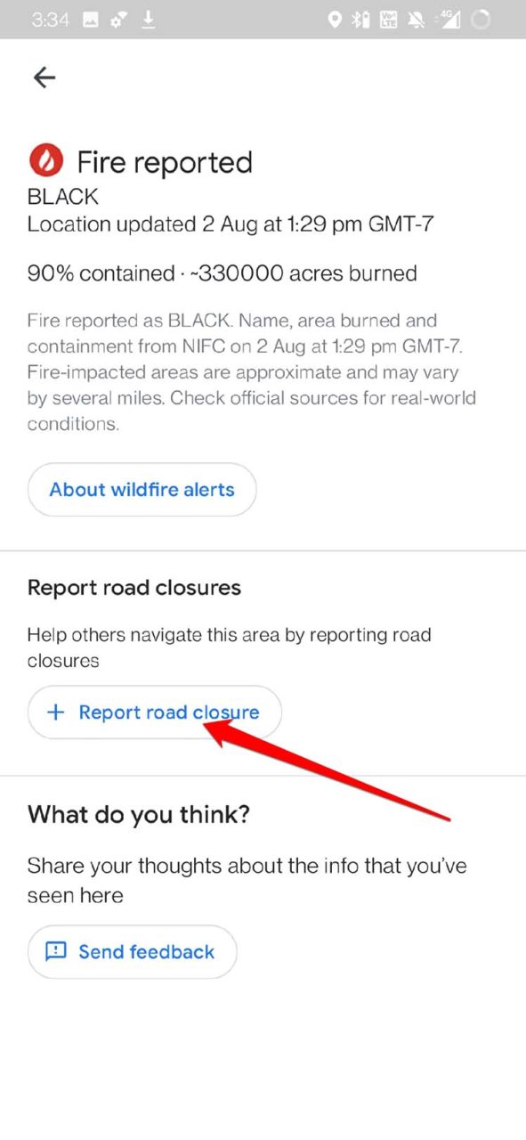
How to Check Wildfires Using Google Maps
Here are the steps to know and be aware of areas engulfed by forest fires that may be a part of the route that you are traveling.
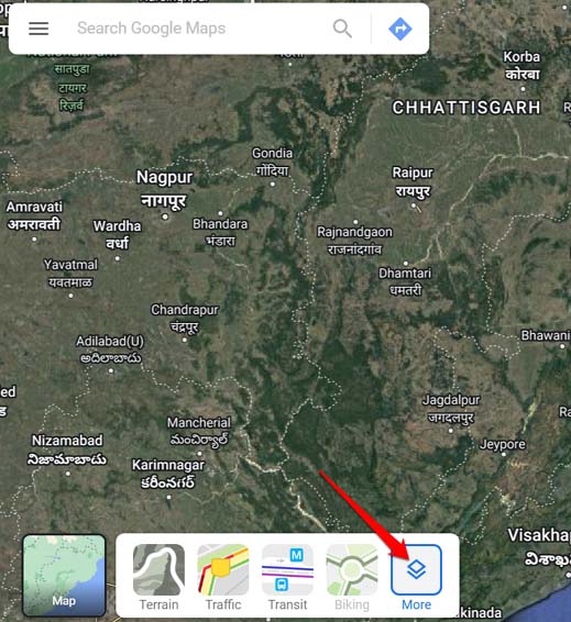
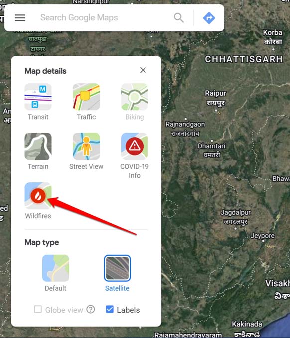
Using Google Maps Web Version to Check Wildfires
Fortunately, if you are using Google Maps on a PC web browser, you can check in detail about ongoing forest fires in any part of the world. It is pretty much similar to the way we checked out wildfires using Google Maps for smartphones. Google works with various government agencies from many nations that research and fetch information related to wildfires.
Conclusion
With Google Maps at your disposal, you do not have to go around browsing for news regarding forest fires or air quality indexes of any region in the world. Use the features on Googe Maps to obtain all the necessary data you need in case you are traveling to a place. So, that’s a wrap on how to check the Air Quality Index and wildfires using Google Maps on a smartphone. I hope it was insightful. If you’ve any thoughts on How to Check Air Quality Index and Wildfires on Google Maps?, then feel free to drop in below comment box. Also, please subscribe to our DigitBin YouTube channel for videos tutorials. Cheers!
![]()